
Until Departure
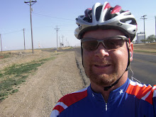
Bike Ride from Amarillo to the Mississippi River along Route 66
Today, I plotted my route through Texas on my Garmin Map. I have decided to start my trip in Amarillo instead of Dimmitt. I want to do this because it takes a day off my trip and I get to see more of Route 66. It will take me two days to get out of Texas.
"The sun is riz, the sun is set, and here we is, in Texas yet."

I will follow a well researched route and try to follow the precise route through the panhandle. I am even going to follow the famous "Jericho Gap".
History of the Jericho Gap.
Jericho Gap Journal
© Delbert Trew
This piece by Delbert Trew describes the infamous Jericho Gap in the Texas panhandle.
Introduction
The High Plains of the Texas Panhandle were formed by deposits of silt washed down by floods from the slopes of the Rocky Mountains. The eastern Panhandle is split by a cap-rock-escarpment dividing the High Plains from the lower Rolling Plains. All waterways in the plains area flow to the east as a general rule.
Topographical maps reveal a narrow winding ridge starting at Jericho and reaching more than sixty miles east to near Erick, Oklahoma. Called Old Trails Ridge by early settlers, this time-worn path has served mankind for hundreds of years. The westernmost portion of the ridge contains the Jericho/McLean segment of today's Route 66/I-40 corridor.
Earliest civilizations were Paleo Indians living in rock pueblos and establishing the Alibates Flint Quarries along the Canadian River some sixty miles north. Later, Apache, Comanche and Kiowa tribes roamed the entire area until 1875 when the U.S. Army placed them on reservations.
The Indians had used Old Trails Ridge annually to travel from winter camps along the creek bottoms of Oklahoma to the High Plains to hunt buffalo. The U.S. Army expeditions used the ridge to pursue the Indians during the Red River Wars. The U.S. Mail Service used portions of the ridge as mail routes between Clarendon, Eldridge, Fort Elliott, Tascosa and Dodge City, Kansas.
Suppressing the Indian tribes opened the area for white settlement from 1876 to 1895 with both free-graze ranchers and farmers arriving each year. In addition, the ridge became the route of homesteaders heading for the newly-opened public lands of New Mexico. Both wagon trains and trail herd drivers used the ridge to reach traditional trails going north and south.
From 1880 to 1900, a mail-coach-way-station drew scattered settlement around close and became known as the Jericho Community taking the name from the Bible. The Rock Island Railroad surveyed, purchased right-of-way and laid track in 1901 and 1902 with the first scheduled train running on July 6, 1902. A side track, depot and cattle loading facilities drew the community to its site and a Jericho Post Office was established.
As local commerce grew, both county and state established “dragged” dirt roads connecting Groom, Jericho, Rockledge, Alanreed and McLean with the road configuration following the railroad right-of-way closely. The railroad and the dirt roads followed the gentle elevations of Old Trails Ridge eliminating costly fills, culverts and bridges.
Early settlers remember the roads crossed the tracks several times and numerous barbed wire gates had to be opened and closed for passage. When rains fell, the rich black soil became “black gumbo“ rendering the roads almost impassable. This “gap” of bad road, in between sections of improved roads east and west, was christened “Jericho Gap” eventually becoming famous in Route 66 History. This journal recalls some of the legend and lore of the Gap.
During the 1890s, tidbits of “before-Jericho-Gap” history recall travelers riding the U.S. Mail coach, arriving at their destinations muddy and frozen or hot and dusty as the season allowed. The two-day trip from Clarendon to Fort Elliott often meant sleeping on the hard ground or sitting upright in the coach seat all night.
In 1884, a U.S. Army water-hauling-detail lost a soldier while hauling water from Spring Tank (Alanreed), when his mount bucked the man off and dragged him to death before the others could catch the horse. The man was buried in the wagon tracks to hide the grave from Indians and the site is lost to history.
In the 1890s, the community of Jericho suffered several deaths to Malaria. The malady was traced to the town's water supply in a nearby canyon. All joined together to remodel and improve the springs to eliminate stagnant water.
In about 1935, Johnny Hermesmeyer a life-long resident of the Jericho community, recalls as a young boy of leading the team of horses that pulled the body of an obese dead woman strapped to a barn door, up the narrow stairway of a dugout so she could be buried. The dugout was located only yards from Jericho Gap.
Before Jericho Gap: 1902–1926
abandoned farmstead
Old farmstead at Jericho
photo © D. Knowles
During this period, wagons evolved into automobiles, wagoneers into motorists and both the State of Texas and the U.S. Government became involved in improving roads. Efforts by the Good Roads Movement and the National Old Trails Movement brought on the Federal Aid Road Act forcing each state to organize a state highway department. Texas formed its department in 1917. By 1921, Congress decreed quotas of good road mileage in each state with interstate design in mind in order to receive federal funds. Local road improvements increased drastically at this time when the burden of cost to local counties was transferred to State and Federal agencies.
Improvements to the Jericho/McLean segment of road were few before 1927 and consisted mostly of local teams of horses pulling county-owned graders, with work provided by “statute labor” where everyone living along the road or close by was expected to help maintain this community-owned road. Photos in the McLean/Alanreed Area Museum show crews of men working on a road site near Alanreed.
Early settlers in Groom recall loading up their cars with pretty girls, driving to Alanreed or McLean to buy watermelons in season. The twenty-five mile trip required most of the day, driving slow, crossing and re-crossing the tracks and opening wire gates every mile or so. On the return trip, they stopped at today's Trew Ranch near a large wild plum thicket to eat watermelon and allow all to go to the bathroom in the thicket.
In about 1907, a local rancher and a real estate agent from Amarillo met at Rockledge to discuss a dispute over a sales commission. The dispute escalated into an argument resulting in both being shot to death in a shoot-out. The nearby railroad section crew witnessed the murders then loaded the bodies onto an empty boxcar of a passing freight train for off-loading at the depot in Alanreed.
1926 to 1933
America's first trans-continental highway was born on November 11, 1926. Starting on the shores of the Great Lakes in Chicago and ending at the beaches of the Pacific Ocean at Santa Monica, congress visualized a paved road the entire distance for the new automobile owners of America. Of the original 2500 miles of new highway, only 800 were improved at the start. In the early 1930s, the four western states had only 64.1 miles of paved roads. The Crash of 1929, the following Great Depression and the disastrous Dust Bowl slowed road improvements and it was 1938 before the last miles were paved.
The legend and lore of Jericho Gap was written during the period of 1927 to 1933. Only with help from the Civilian Conservation Corps (CCC), and the Works Progress Administration (WPA), did improvements to the “Gap” occur. However, before and during the improvements to Route 66 which was removed some distance to the north, history was written as the travelers experienced more than their share of crude, road-travel experiences along the mileage of old Jericho Gap.
The new-age automobiles could move on the open highway but were helpless in the gooey, gummy mud of Jericho Gap. Tires spun, mud balled up under the fenders and if your car fell into the deep ruts, you were there until someone pulled you out. Mud tires or chains helped but were not infallible. A tow-chain and shovel helped but once stuck, only a team of horses or a tractor could extract your car from the gumbo. Lord help anyone who was in a hurry along Jericho Gap.
One unproven but likely story accused local farmers living along Jericho Gap of hauling water at night to fill the ruts of the Gap providing more income from stranded travelers the next day. Of interest was the fact that nearly every farmer along the route owned a water tank on wheels!
A young boy named Rush Turner lived east of Alanreed along the “Gap” and found a Greyhound Bus stuck in a ditch near his home. He “fetched” his pa and his team of mules to pull the bus back onto the road. He was promised one dollar for his work and five dollars for his pa's team but had to ride the bus to Alanreed to get the money. It was his first ride on “rubber tires,” plus he had to walk home, but considered it to be his greatest adventure to date.
In April of 1928, the Great Footrace Across America, also known as the Bunion Derby, traveled the full length of Jericho Gap just after an April snow storm. One runner fell injured and had to drop out of the race. All the cars, busses and trucks in the race entourage were stranded in the mud of the Gap for hours while the runners raced on to Alanreed and McLean. Jericho Gap had no mercy on the rich and famous as well as the poor and impatient who tried to pass through its portals.
1933 to 1952
The Jericho Gap/McLean segment of Route 66 stayed in a continual flux of change from 1927 to 1952. The Triple A Guidebook in 1931 shows 194.7 miles of Texas Route 66; later resources show only 184 miles and today's mileage has shrunk to 178 miles.
The original configuration has continually been re-routed, up-graded and altered. In addition road bases, road widths and surfacing, driving rules, laws and driving habits have changed. Increasing traffic numbers, faster speeds and more trucks demanded straightening out curves, cutting down hills, filling in valleys and by-passing areas of slower driving.
Road construction and highway construction equipment improved. The discovery and use of “birds-eye caliche” for a road base under final surfacing was a blessing along Jericho Gap. Nature provided many such deposits from Jericho to McLean. The old pits are still in sight for travelers to see today.
Finally, a new route was chosen from Groom to McLean staying north of the railroad tracks thus eliminating the mud of Jericho Gap, the railroad crossings and by-passing many curves and sharp corners along the old route. Relegating the gumbo mud to the past was welcome news to travelers. Sadly, these inconveniences which made the Gap famous were replaced by a new factor.
The speed and impatience of modern motorists began causing wrecks in unprecedented numbers. Local citizens, observing these occurrences daily, coined the nickname “blood alley” for the new configuration. Eventually, new hospitals were built at Groom and McLean verifying the new dangers. A new era had been introduced to Route 66 travelers.
Almost overnight automobiles traveled at sixty miles per hour instead of thirty. Lightweight trucks grew into heavily-loaded semi-trailers, hard to turn or stop and even harder to pass on the highway. All vehicles seemed larger and wider, especially when being met or passed on the outdated narrow pavement.
Compounding the problem, better sections of road existed to the east and west with long straight stretches of highway to enjoy. When travelers reached the hills and curves of the Jericho/McLean segment their impatience turned to frustration with some causing horrible wrecks and devastation. It became a sad chapter in Route 66 history.
The blood-alley-chapter in Texas Route 66 history is still being argued today as to whether it was a human disaster or a bonanza for entrepreneurs along the route. A boom in traveler's services occurred during this time with motels, cafes, service stations and garages being built. Also, ambulance services, wrecker/tow concerns and additional law officers were added and the new hospitals paid for. Sadly, highway improvements did not keep up with increased traffic. Death, injury and loss of property continued to rise until the early 1950s when the dual lanes were built.
“One day we were going to Groom for tractor parts and came upon a head-on wreck at the Lake McClellan road. A driver suffered a heart attack and pulled into an oncoming vehicle. Three were dead and we pulled a live woman with her throat cut from the burning crash. We placed her into a passing empty hearse and he rushed her to the Groom hospital where she survived. You never knew what to expect.”
“A ranch cowboy and I were riding in the pastures and heard a crash up on the highway. We ran our horses to the site, tied them to the fence and helped pull the truck driver and one live passenger from a car. The truck was loaded with Post Magazines for the southwest part of the United States. The load burned for days and no one in the southwest received their magazines that week.”
“Once my brother and I were hauling a heavy load of livestock feed near Alanreed and were traveling through a road construction area. A speeding car passed us, skidded on the loose gravel, hit a sign post and ejected a woman from the rear seat into the path of our truck. I braked sharply, veered into a deep ditch nearly turning the truck over in the process. After stopping, we ran back to attend the woman. We encountered a very mad person, with shorts and panties pulled down revealing badly skinned buttocks and upper legs. We stood with the woman's husband and took a cussing that would have made a hardened sailor blush.”
1952 to 1975
The “blood alley” chapter of the Jericho Gap/McLean segment came to an end in the early 1950s when dual, parallel highways were built. It was believed at the time, the wide thoroughfares, one-way designations and wide median would eliminate wrecks and crashes.
This was not the case. Head-ons and multiple crashes were replaced by single rollovers caused by higher speeds and driver exhaustion. The tremendous increase in traffic numbers also increased the numbers of strange and weird travelers. Route 66 has always seemed to have more than its share of such characters.
The late Emmet Allen, a Texas Route 66 Hall of Fame inductee, once had a customer come into his Alanreed garage. The man had generator problems and was a “spy” who was being watched by the CIA. After much whispering and sneaking around, Emmet wised up and told the man he wasn't cleared for working on spys' cars. He jumped the car battery and sent the man on his way.
Emmet also once made extensive repairs to an elderly couple's car and suspicioned he might not get his money when finished. The old couple slept in the car and ate crackers and cheese for two days and nights. When time came to settle up for the bill, Emmet had to sort through $6,000 in cash in the man's wallet to get his pay.
Shortly after the dual lanes of Route 66 were completed, a drunk woman entered the east bound lane going the wrong way in heavy fog. She eluded the Highway Patrol, Sheriff's Deputies, barely missed a bunch of oncoming cars and pulled into the Alanreed Coffee Shop parking lot. The scanners were going crazy trying to get this woman off the highway. Emmet was drinking coffee when an alert cashier saw the woman pull in. She told Emmet to go get the woman's car keys before she killed someone in the fog. When Emmet approached the car and reached through the window to snatch the keys, the woman bit him. He got the keys but had to go to the doctor's office for stitches and a tetanus shot. He received unmerciful teasing about catching “mad-woman's-disease.”
“We had a truck driver in our coffee shop one morning that had hit a huge black Angus bull standing on the highway just before daylight. The man's eyes were big as saucers, his hands still shook and he had to go to the bathroom every few minutes. He had topped the hill about half asleep and running hard when he saw the bull at the last moment. He thought it was a black elephant and vowed to never drive at night again.”
1975 to Modern
Modern rest area
Modern rest area near Jericho Gap
photo © D. Knowles
The modern-day configuration of the Jericho/McLean segment of Route 66/I-40 is complete with dual concrete highways, overpasses, controlled access, wide medians, service roads and by-passed towns. It offers the best money can buy for the time-conscious, modern-day traveler. Yet, the strange happenings, weird travelers, vehicle accidents and crime continue to occur.
The old Jericho Gap, most stretches of old Route 66 and the Mother Road structures of the past now require maps and special guides to locate. Only trash heaps and crumbling foundations mark many of the famous businesses of the past. A few of the best sites have been restored, thanks to the Route 66 Associations and The Texas Department of Transportation. New Safety Rest Stops provide the latest in tourist facilities and several new tourist attractions have been added.
The most significant effort to date is the collection and gathering of Old Route 66 information, photos and stories. These will always be here for the future historians of the Route.
“Among the many modern-day adventures of the Jericho/McLean segment, we were asked to help film a scene for a documentary about the Bunion Derby taking place in 1928. Although it was a hot July day, temperature above 100 degrees, we helped spread white laundry soap on a section of Jericho Gap roadway, spray white foam and paint on roadside grass and weeds, then operate commercial-grade fire extinguishers blowing white powder into the wind simulating a Texas April snow storm in 1928. When a young Andy Paine look-a-like jogged past into the blowing snow the effect was so real on the monitor I couldn't believe my eyes.”
At mile 131, alongside today's I-40, old Route 66 is the south service road lying beside the abandoned Rock Island Railroad right-of-way. Both skirt a large playa lake located on the Trew Ranch. There are two huge holes in the bottom of the lake with life-long ties to the history of the past and the future of the area. Thousands of yards of black gumbo dirt, like that along Jericho Gap, was removed from the holes and used to plate the medians of I-40 from Jericho to Alanreed so that grass would grow and hold the soil. Today, that same gumbo soil is being used to line and seal the land-fills of McLean and is destined to line the new waste water lakes to be built just south of town.
No longer would the old timers from Groom have to stop at the wild plum thickets to use the bathroom. New multi-million dollar rest rooms now provide relief, overnight parking, picnic facilities and beautiful glimpses of Texas. Ironically, one of those rest stops now sits astraddle a section of famous old Jericho Gap.
So I thought this was really interesting. However my question is, if I'm suppose to be comfortable with this ride that you plan. Why are you writing about how dangerous and deadly it is? My worry meter just shot up again.
ReplyDeleteHowever, very interesting.
Why the worry meter? All the bad stuff happened a long time ago.
ReplyDelete